If you’ve ever calculated the area of a surveyed land plot manually, you already know the struggle.
You start confident.
Then the coordinates get longer.
Then the calculator batteries mysteriously weaken.
Or one wrong digit ruins everything and you don’t even know where.
There is a better way, and no, it doesn’t involve suffering for character development.
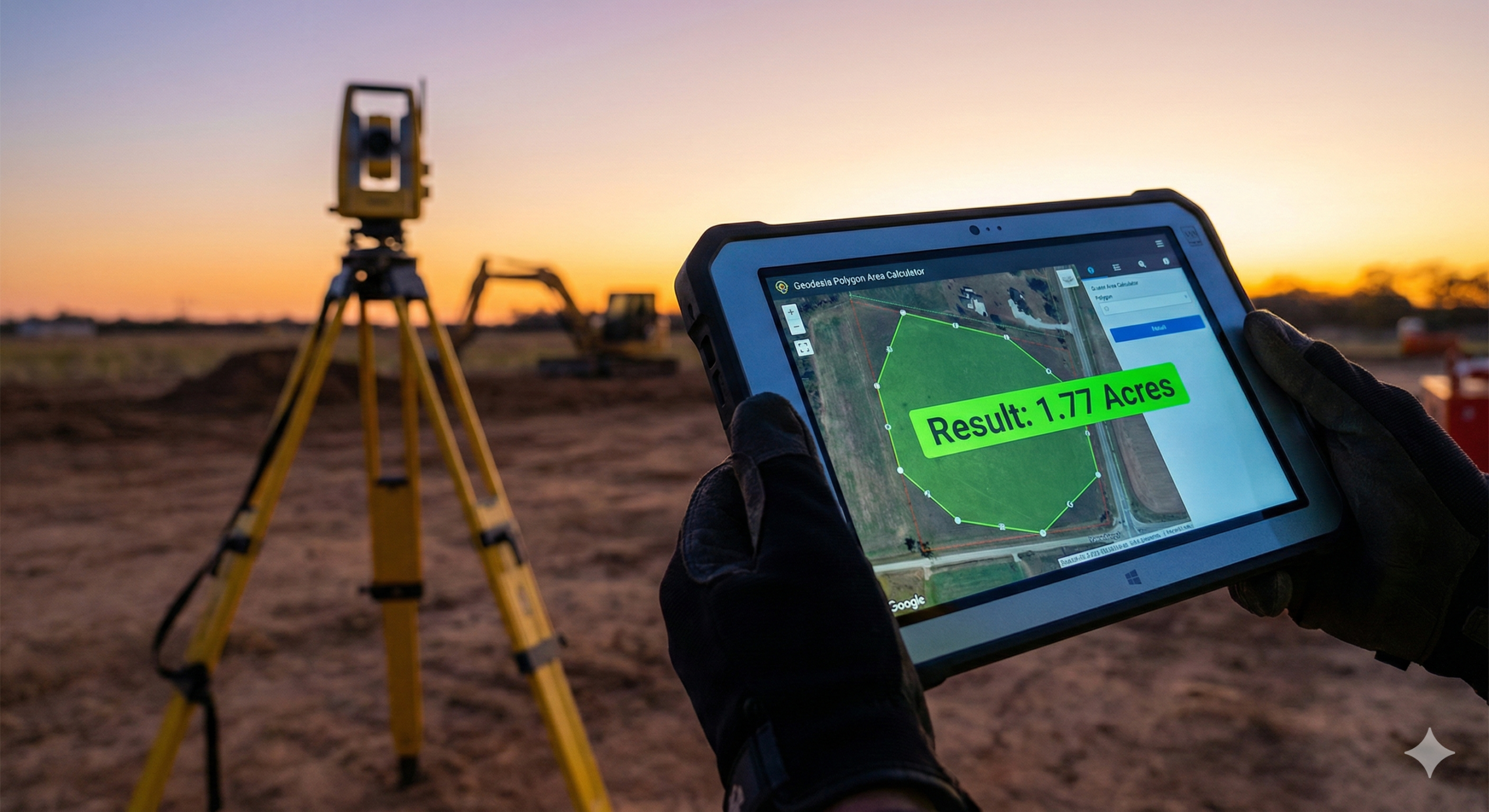
Meet the Polygon Area Calculator by Geodesia Online. A simple, professional online tool built for people who already have surveyed coordinates and would rather not do 30 lines of arithmetic by hand.
What This Tool Is (and Why It Exists)
This tool does one thing very well:
It calculates the area and perimeter of surveyed land plots using coordinate data.
You paste in your XY or UTM coordinates, hit calculate, and it instantly gives you:
- Total area
- Perimeter
- Individual side lengths
- Even the centroid of the plot
All powered by the Gauss Shoelace Formula, which sounds fancy but is actually the exact same method surveyors are taught in school. The difference is the tool doesn’t get tired, distracted, or emotionally attached to a calculator.
Why Surveyors and GIS PROFESSIONAL Actually Like It
Let’s be honest. Manual calculations are not “more professional”. They’re just slower.
Here’s why this tool makes sense in real-world surveying and GIS work:
It Saves Time
Whether your plot has 6 points or 26, the tool doesn’t care. The calculation time stays the same: seconds.
It Uses Proper Survey Mathematics
No approximations. No guessing. No black-box magic.
It uses the Gauss (Shoelace) Formula, the same planar method used in surveying, geomatics, and GIS.
It Reduces Human Error
Most area mistakes don’t come from bad surveying. They come from:
- swapped digits
- missed brackets
- tired eyes
- “let me just redo this quickly”
Automation quietly eliminates all that.
It Produces Professional Outputs
You can export results as PDF or Excel, which means:
- clean reports
- easy sharing
- fewer “how did you get this number?” conversations
Who This Tool Is Perfect For
This calculator is ideal if you are:
- A surveyor doing quick area checks
- A GIS professional validating parcel geometry
- A student learning coordinate area computation
- A planner or engineer working with site boundaries
- Anyone who already has surveyed planar coordinates
If your data is in UTM or local grid coordinates, you’re exactly the target audience.
What This Tool Is Not Trying to Be
Let’s keep expectations realistic.
This is not a replacement for:
- Full cadastral survey software
- Geodetic computations over very large areas
- Legal boundary definition workflows
It assumes planar coordinates, which is perfectly fine for surveyed plots, sites, and parcels. Use the right tool for the right job. This one just happens to be very good at its job.
Why This Matters
Time saved on calculations is time spent on:
- checking your work
- improving accuracy
- explaining results to clients
- or simply finishing earlier
Surveying is already demanding enough. Your calculator doesn’t need to be part of the challenge.
Try the Polygon Area Calculator
If you’re tired of manual area calculations and want fast, accurate, survey-grade results, this tool is worth bookmarking.
Polygon Area Calculator
No drama. No guesswork. Just clean geometry doing what it’s supposed to do.
Leave a Reply