-
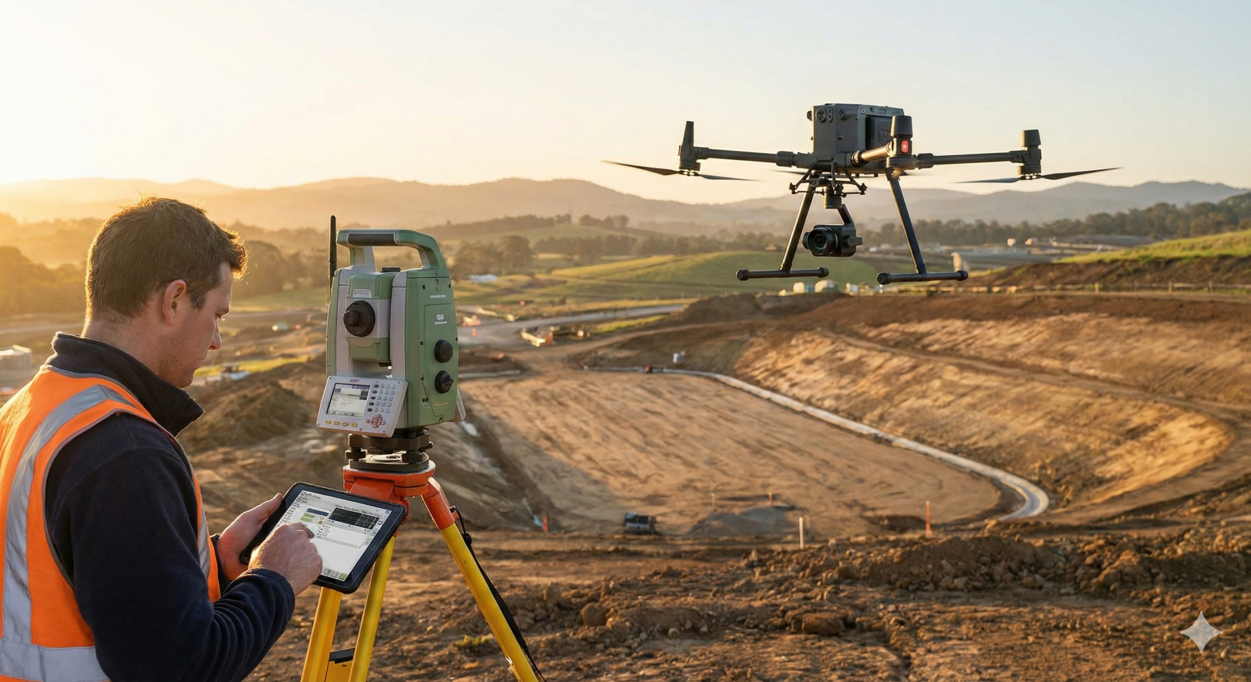
There used to be a specific rhythm to a land survey. You knew the day would involve the heavy clunk of the tripod legs, the smell of crushed grass as you cut a line of sight, and the quiet focus of staring through the glass. It was slow, it was deliberate, and it was the…
-
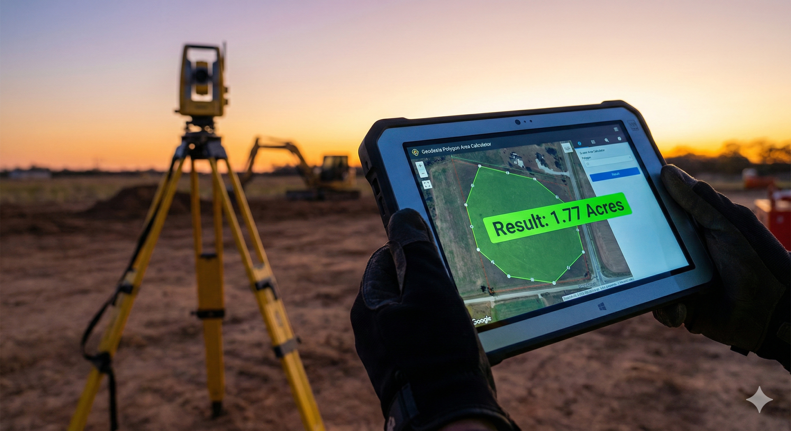
If you’ve ever calculated the area of a surveyed land plot manually, you already know the struggle. You start confident.Then the coordinates get longer.Then the calculator batteries mysteriously weaken.Or one wrong digit ruins everything and you don’t even know where. There is a better way, and no, it doesn’t involve suffering for character development. Meet…
-

The era of the authoritative, top-down map is over. For today’s geospatial professional, a new paradigm has emerged: crowdsourced cartography. This shift moves the tools of creation from the expert’s office into the public’s pocket, fundamentally changing our role. We are no longer the sole creators of geographic data. Instead, we have become the essential curators,…
-

In today’s data-driven landscape, Geographic Information Systems (GIS) has evolved far beyond simple map-making. It’s a sophisticated convergence of technology, spatial analysis, and visual storytelling that’s transforming industries from urban planning to environmental conservation, logistics to public health. Whether you’re an IT professional seeking to expand your technical repertoire, a surveying graduate looking to modernize…