There used to be a specific rhythm to a land survey. You knew the day would involve the heavy clunk of the tripod legs, the smell of crushed grass as you cut a line of sight, and the quiet focus of staring through the glass. It was slow, it was deliberate, and it was the only way to get the job done.
Today, that rhythm is changing. Walk onto a site or a large quarry project in the rift, and the soundtrack isn’t the beep of a button—it’s the high-pitched hum of a rotor.
Drones have stormed the geomatics industry with the confidence of a new graduate. They promise to do in thirty minutes what used to take a crew three days of sweat and machete work. This has led to a lot of excited chatter, and a quiet anxiety among some veterans: Is the Total Station becoming a relic? Are we looking at the end of the tripod era?
The answer is a lot more interesting than a simple “yes” or “no.”
The Allure of the “Flying Tripod”
Let’s give credit where it’s due: Photogrammetry is seductive. If you have ever spent a week battling thistles to shoot a grid for a topographical survey, watching a drone capture the same 50 acres while you drink coffee from the tailgate feels like magic.
For volumetric analysis and large-scale mapping, the drone is undeniable. It doesn’t just give you points; it gives you the world. Clients love the rich 3D models and orthomosaics because they are pretty and easy to understand. A colorful Digital Terrain Model (DTM) sells a vision to a developer much faster than a black-and-white contour map ever could.
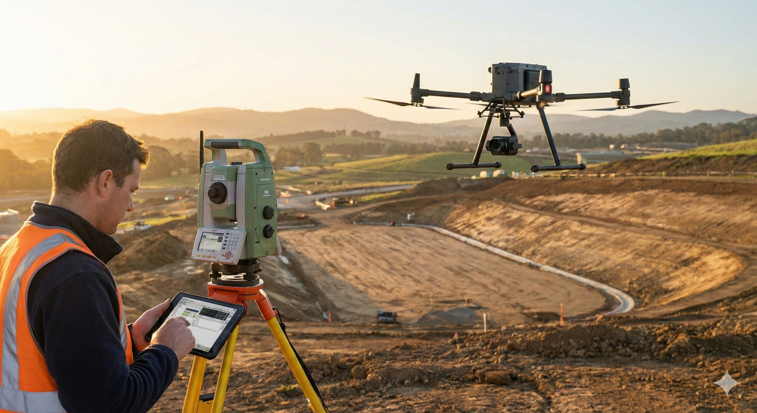
But… Can It Find the Corner Pin?
However, before we throw our prisms into the store, we need a reality check. There is a massive difference between a “pretty picture” and a legal boundary.
The biggest enemy of the drone—especially here in East Africa—is nature itself. Photogrammetry relies on the camera seeing the ground. If you are surveying a dense coffee farm or a bushy plot, the drone sees the canopy, not the earth. A surveyor with a rod can punch through the leaves to find the true ground level. A drone cannot.
Then there is the issue of precision versus accuracy. A drone map might look perfect, but without rigorous Ground Control Points (GCPs), it can “float” by meters. When you are re-establishing a boundary beacon that will determine property ownership, “close enough” is dangerous. You cannot resolve a neighborly land dispute with a pixelated image; you need the millimeter certainty of the Total Station.
The Modern Surveyor’s Toolkit
The truth is, the Total Station isn’t dying—it’s just getting a teammate.
The most successful surveyors today aren’t choosing sides. They are using the Hybrid Workflow. They fly the drone to get the big picture and the volume data, but they keep the tripod set up to verify the boundaries, shoot the control points, and handle the precise setting out for columns and foundations.
The real challenge now isn’t in the field; it’s in the office. Managing these two different streams of data—combining the massive point clouds from the sky with the precise coordinates from the ground—can be a headache. You’re constantly converting between WGS84 (what the drone sees) and local grids like Arc1960 or UTM (what the deed says).
So, don’t sell your Total Station just yet. It might not be as flashy as the new bird in the sky, but when the legal lines need to be drawn, it’s still the boss of the site.
Leave a Reply